Webster Dam
Published May 27, 2025
Trail in Madison County, Idaho
Webster Dam Hike – Madison County, Idaho
Approx. 2.5 miles (out-and-back) | Difficulty: Moderate | Time: 1-2 hours round trip
Guest Blogger – East Idaho Adventures
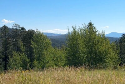
Hidden in the scenic backcountry of Madison County, Idaho, the hike to Webster Dam offers a refreshing blend of forested paths, rolling terrain, and the rewarding sight of cascading falls nestled at the end of a moderately challenging trail. Though not widely publicized, this hike is beloved by locals and frequent travelers who appreciate a more rugged, authentic Idaho outdoor experience.
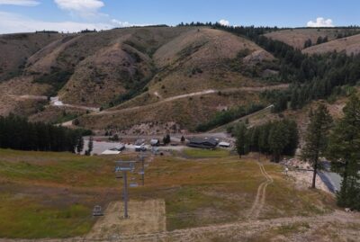
Getting There and What to Expect
Webster Dam is a well-used trail, just not a well-marked one. Because of the unmarked paths and limited signage, it’s strongly recommended to use a GPS-based trail map like AllTrails, especially for first-timers. The trail is well-trodden which makes it easy to follow early on and even though the trails split off, they come back together. These different trails make it so you can choose your level of steep you want to do when hiking there and back.
Early in the hike, about ½ mile in, you’ll notice several forks in the path. While they may seem confusing, most lead back to the same general direction and converge. Still, to avoid unnecessary backtracking, keep to the more heavily used paths. There will start to be trails that take strong turns about 1 mile in, you’ll want to stay on the power line trail that is more heavily used. You follow the power line trail for a good while but about just about 1 mile into the trail, you will want to choose carefully. This is the fork where you will want to go left, see video below.
This part of the trail enters a lush, green forest area. This part is not only the most scenic stretch in my opinion but also the easiest route down to the falls—another reason to follow the AllTrails path if you’re unsure.
Due to the patchy cell service in this area, it’s smart to download the AllTrails map ahead of time or take a screenshot of your route. That simple precaution can save you time and ensure you take the most direct and enjoyable route. Stay on the most travelled path and it isn’t as confusing at this part. You will hear the falls as you get closer and find it easily. Getting to the falls is easy – going back up is steep and tiring but not treacherous.
The Trail Itself
At roughly 2.5 miles round trip, the trail is a manageable 1-2 hour hike, though the path is steep in some sections and will certainly get your heart rate up. It’s not treacherous by any means, but it’s definitely a workout. The trail is relatively well travelled for much of the journey since the ATV’s drive this trail often.
One of the best aspects of this hike is its shade. The trail winds through wooded areas, offering plenty of protection from the summer sun. This makes it a great choice for mid-day excursions, especially on warmer days. The first half of the trail is not as shaded but there are trees along the way. The second half of the trail heads into a wooded forest, that is gorgeous by the way, and is very much shaded. Which is perfect because the way back is harder than the way down and tiring.
The trail is multi-use and welcomes a variety of adventurers. You’ll likely encounter ATV riders, mountain bikers, horseback riders, and hikers all sharing the path. Even though this trail is well travelled, it’s a good idea to bring bear spray—just in case. While bear encounters are rare, it’s better to be safe. You can never be too prepared.
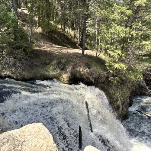
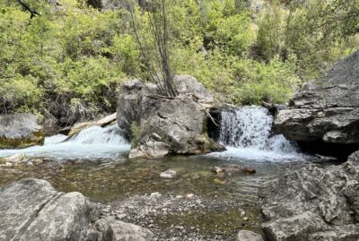
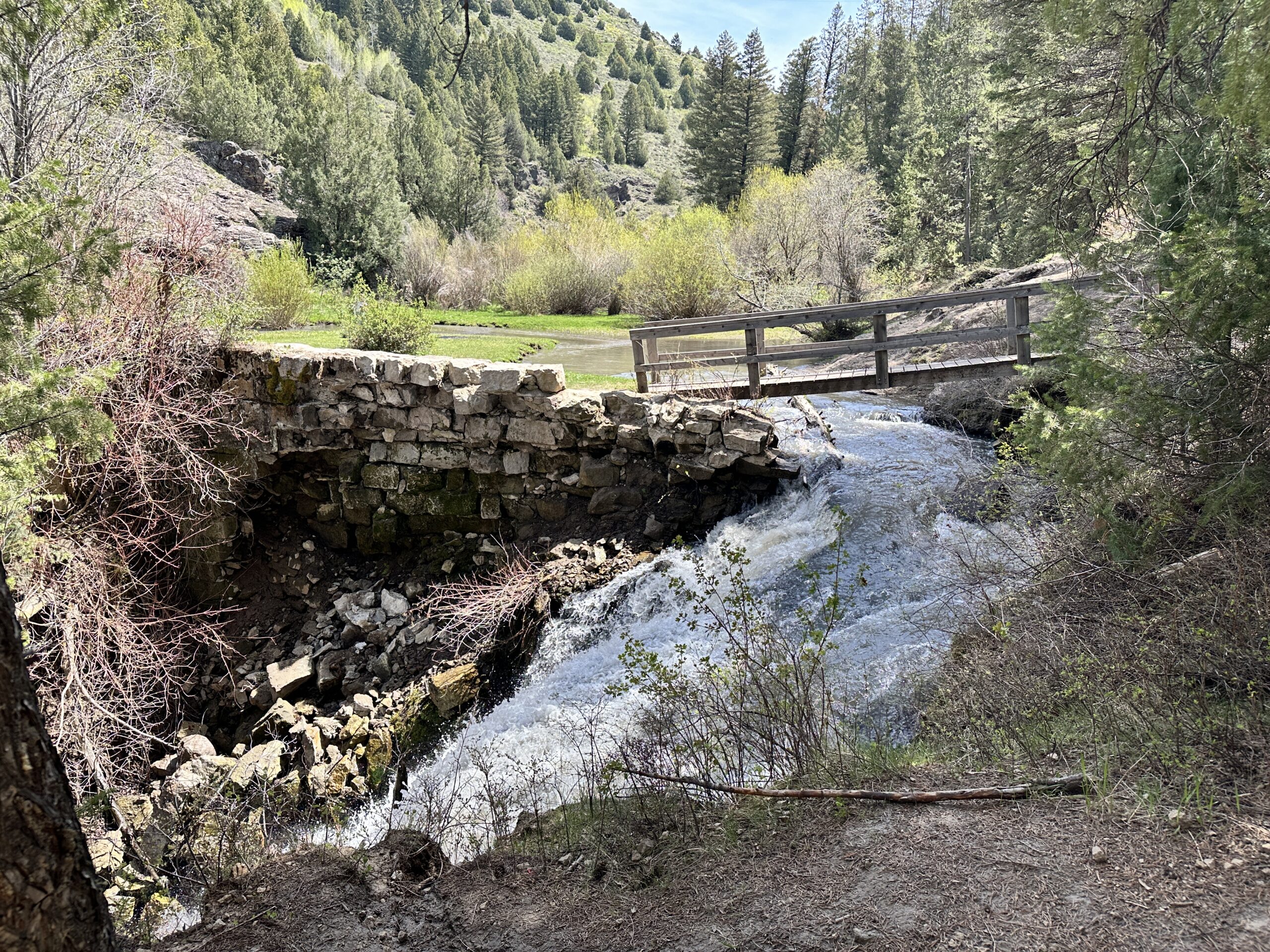
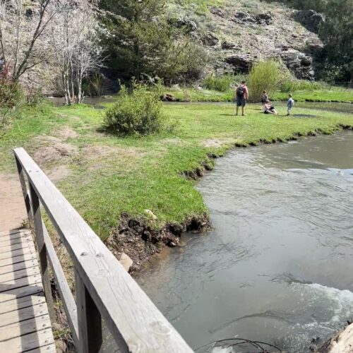
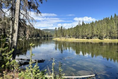
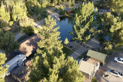
Destination: Webster Dam and Falls
After roughly an hour of hiking (for a young family like mine), you’ll reach the dam and falls—a picturesque spot that serves as the highlight of the journey. The dam, though man-made, doesn’t take away from the natural beauty of the area. The surrounding cliffs, moss-covered rocks, and tumbling water make this a perfect location for a family photo, a quiet moment of reflection, or a relaxing picnic.
There’s a lovely grassy area near the falls, ideal for spreading out a blanket, enjoying a meal, and soaking in the ambiance. There isn’t a lot of shade around the grassy area but not to worry because you can dip your feet in the freezing cold water. It is shallow on the far end of the grassy area.
Things to Keep in Mind
Navigation: The trail isn’t marked, and forks can be confusing. Use AllTrails and download your map before you lose service.
Safety: Bear spray is a wise precaution. Let someone know your plans before heading out.
Trail Conditions: Though well-paved in areas, the trail can be tiring and steep in spots. Wear appropriate footwear and bring water.
Multi-Use Trail: Expect to share the trail with various types of travelers—stay aware and courteous.
Family-Friendly: The hike is suitable for active families. It took our family one hour each way, with a few short breaks and time to admire the scenery (and collect sticks).
Here is a short video of Webster Dam!
Final Thoughts
Webster Dam in Madison County is a gem tucked away in the Idaho backcountry. Though it may require a bit of route-finding and stamina, it rewards hikers with shaded trails, diverse terrain, and a tranquil, waterfall-fed oasis at the end. The lack of signage adds a slight element of adventure, making this more than just a simple day hike—it becomes a genuine summer outing.
Add this trail to your summer adventures. Whether you’re hiking, biking, or riding, Webster Dam is a place to unplug, reconnect with nature, and create lasting memories. So lace up your boots, pack a lunch, and don’t forget that picture of the AllTrails map—Webster Dam is calling.

Guest Blogger – East Idaho Adventures


More Family Fun With
East Idaho Adventures

Idaho Falls Luxury RV Park

Menan’s Haunted Hemp Maze
Kelly Canyon Trail

Connie’s Restaurant & Saloon
Coffee Pot Rapids Trail
Mountain River Ranch

Xhale Resort & Spa
Snake River Roadhouse